L’Oltrepò Pavese è un’area geografica della Regione Lombardia, posta a meridione del corso del Po ed inclusa nella Provincia di Pavia, ha una superficie di circa 1.100 Kmq, comprende settantotto comuni e confina con le province di Alessandria, Genova e Piacenza. E’ un territorio ad elevata accessibilità nazionale ed internazionale, ben servito dall’autostrada A21 Torino‐Piacenza‐Brescia (Autostrada dei vini) con un casello presso il Comune di Casteggio, e dall’autostrada A7 Milano-Genova con un casello a Casei Gerola.
La diversità dei paesaggi caratterizza questo territorio: da nord verso sud troviamo una breve pianura alluvionale, poi L’Oltrepò pavese collinare e la vasta zona montana. Per la presenza di aree agricole di pregio principalmente in ambito collinare, una buona qualità ambientale e la presenza di risorse umane qualificate, si può affermare che in Oltrepò Pavese l’interazione fra uomo ed ambiente non ha deturpato la superficie territoriale e la qualità del prodotto vinicolo è associata alla qualità del paesaggio.
Il nostro territorio è di grande interesse naturalistico, paesaggistico, storico ed artistico, scenario ideale per trascorrere giornate piacevoli, offre la possibilità di visitare suggestivi edifici religiosi, passeggiare nei borghi alla scoperta di antiche architetture e castelli, visitare le cantine, i musei, pranzare nei numerosi ristoranti ed agriturismi, praticare cicloturismo ed ammirare suggestivi panorami dai numerosi belvedere.
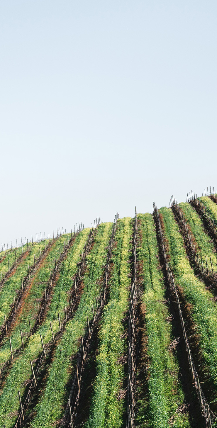


Oltrepò Pavese nel Comune di Corvino San Quirico
Questo territorio fu anticamente sede di una villa rustica di proprietà della famiglia romana detta dei Corvini, da qui probabilmente deriva il toponimo Corvino, che troviamo citato per la prima volta in un documento del 936 quando Ottone I dona la corte al monastero di San Salvatore di Pavia.
Il Comune
Fino al 1871 il comune mantenne la denominazione di Corvino, da questa data in poi si chiamò Corvino San Quirico.
Segui la direzione
Le strade provinciali che attraversano la zona collinare sono di grande interesse panoramico, anche se è possibile godere di suggestive viste del territorio collinare dalla via Emilia (ex Strada Statale n. 10).
Punto di riferimento
La frazione Fumo è il maggior centro abitato, si estende in pianura ed è attraversata dalla strada statale, qui si trova l’elegante Santuario della Madonna di Caravaggio inaugurato nel 1939 da Don Orione.
Posizione
Il Comune è comodamente raggiungibile, si sviluppa parte in pianura e parte in collina, risulta compreso tra i 80 e i 263 metri sul livello del mare, l’escursione altimetrica complessiva è circa di 183 metri.
Via Mazzolino 14
27050 Corvino San Quirico (PV)
Tel: 0383 876187 – 334 1424154
info@cavallini1919.it
P.I. 01827450188